English
 Dutch
Dutch Japanese
 Hindi
Hindi Italian
 Spanish
 French
 German
 Chinese
 Korean
 Arabic
 Hebrew
 Russian
 Portuguese
 Danish
 Czech
Czech Polish
 Swedish
 Share
ShareLangtang Lirung Avalanche and Bhotekoshi Flood 2026: Cause, Damage, Death Toll and Rescue

 Updated: 8 September, 2026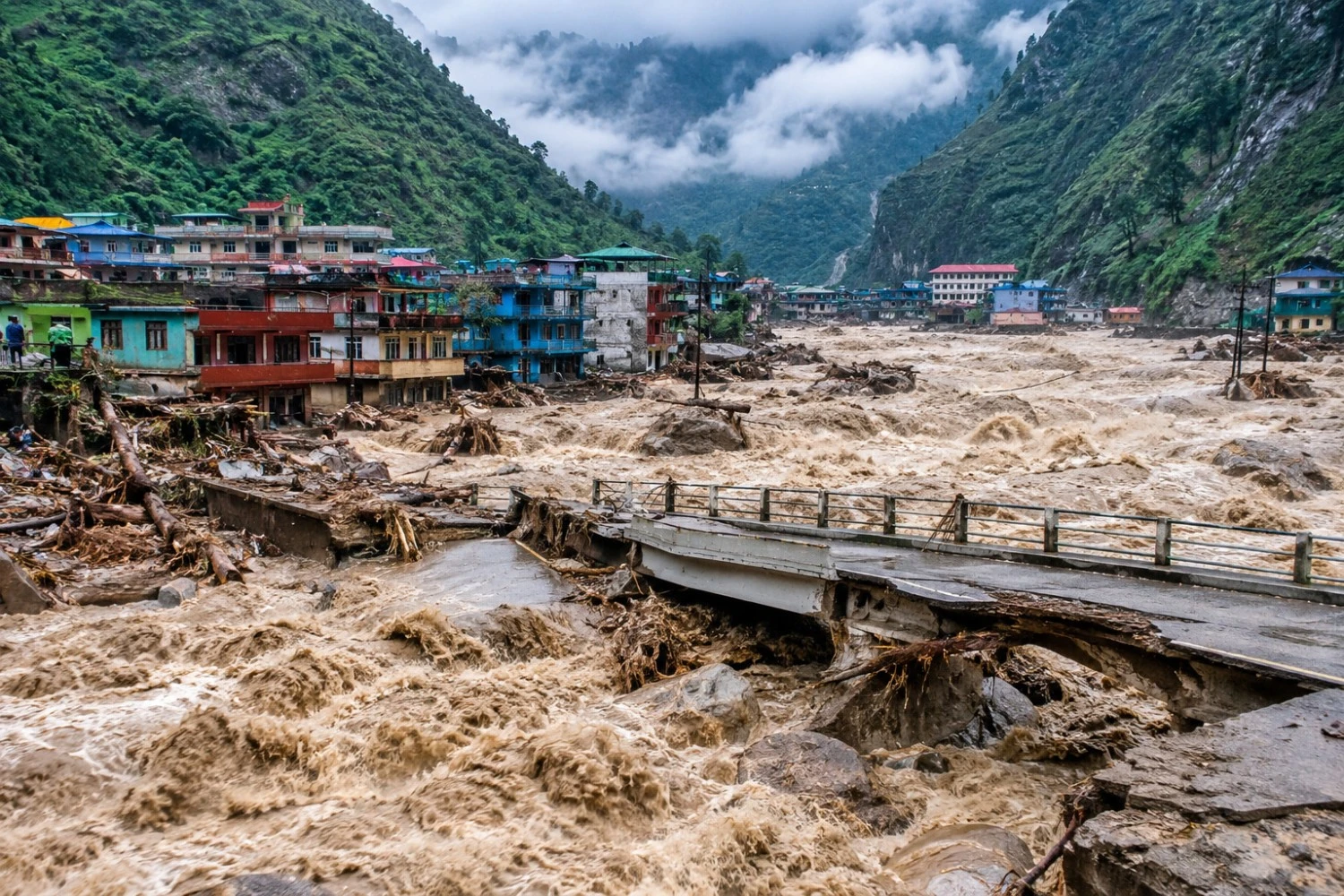
On the morning of 26 August 2026, a huge block of ice and rock broke off Langtang Lirung. It fell into the valley below. As it fell, it picked up mud, water, boulders and trees. Within minutes, the fall turned into a flood. Within hours, the flood had travelled almost 100 kilometers. It passed through five districts in central Nepal. It destroyed border posts, hydropower stations, whole towns and large areas of farmland.
Thirteen days after the disaster, Nepal is still conducting search, recovery and identification operations. According to the Government of Nepal’s latest update at 2:00 p.m. on 7 September, 1,355 bodies had been recovered, 4,996 people remained missing or unaccounted for (including approximately 900 missing hydropower workers), and 13,396 people had been rescued. The missing-person figure includes approximately 589 foreign nationals from 35 countries. Preliminary estimates place the total economic loss at NPR 400 billion. These numbers remain provisional because search, forensic identification and verification are continuing.
Prime Minister Balendra Shah addressed parliament as the government continued to move from the immediate rescue phase toward relief, recovery and reconstruction, while tunnel searches and body-recovery operations were still continuing. The government has not treated the rescue operation as complete: specialised teams from India, China, South Korea, Malaysia and other countries continued working with Nepali security forces at damaged hydropower projects on 7 September.
A rock-and-ice avalanche struck the Langtang Lirung area on 26 August 2026, generating a destructive debris flow and flood through the Lhende Khola, Bhote Koshi and Trishuli river systems. The disaster affected Rasuwa, Nuwakot, Dhading and downstream districts, with bodies later recovered far from the original impact zone.
By 7 September, Nepal had recovered 1,355 bodies, rescued 13,396 people and continued searching for 4,996 missing people, including approximately 589 foreign nationals. Rescue teams were still working at several hydropower projects, where workers were believed to be trapped in tunnels. Four people were rescued alive between 4 and 5 September, including two Nepali workers from the Upper Trishuli 3A tunnel, one Chinese national from the Upper Trishuli 1 tunnel, and one Nepali national found inside a house in Betrawati.
Key Facts at a Glance
The table below shows the key numbers from the disaster. Each figure has a date and a source. Several numbers have changed a lot from one day to the next.
| Item | Figure | Source and date |
| Bodies recovered in Nepal | 1,355 | Government of Nepal update, 7 September |
| People still missing | 4,996 (includes ~900 hydropower workers) | Government of Nepal update, 7 September |
| Foreign nationals still missing | Approximately 589 from 35 countries | Government of Nepal update, 7 September |
| People rescued | 13,396 | Government of Nepal update, 7 September |
| People rescued alive (4–5 Sept) | Four | Government of Nepal update, 7 September |
| Houses affected | Approximately 7,570 | Preliminary RDNA, reported 6 September |
| People affected by housing damage | Approximately 32,933 | Preliminary RDNA, reported 6 September |
| Government offices affected | 48 | Preliminary RDNA, reported 6 September |
| Roads damaged | 55 kilometres | Preliminary RDNA, reported 6 September |
| Motorable bridges damaged | 37 | Preliminary RDNA, reported 6 September |
| Suspension bridges damaged | 68 | Preliminary RDNA, reported 6 September |
| Agricultural land damaged | Approximately 1,806 hectares | Preliminary RDNA, reported 6 September |
| Hydropower projects affected | 13 | Preliminary RDNA, reported 6 September |
| Solar power plants affected | 1 | Preliminary RDNA, reported 6 September |
| Transmission lines affected | 2 | Preliminary RDNA, reported 6 September |
| Hydropower capacity affected | Approximately 783 MW | Preliminary RDNA, reported 6 September |
Search and recovery work is still going on. So is the damage assessment. Treat every number in this article as a snapshot, not a final count. The count of bodies recovered and the number of damaged homes have both changed every day since the disaster began.
What Caused the Bhotekoshi Flood: The Langtang Lirung Collapse Explained
The disaster began when a slope gave way on Langtang Lirung. The peak rises 7,234 metres. It sits inside Langtang National Park, close to the border with China. The collapse started at about 5,200 metres. What came down was not a single block of ice. It was a mix of glacier ice, rock, snow and loose gravel.
It took most of a week for scientists to work out even that much. The first reports blamed an earthquake. Then they blamed a burst glacial lake. Both explanations turned out to be wrong. More evidence kept arriving and proved them false. Part of the problem was the collapse itself. It destroyed the instruments that would normally record such an event. So researchers had to piece the story together after the fact. They used satellite images, seismic traces and video shot far downstream.
Three findings stand out from that work. The first is what the seismic record actually captured. The second is why the glacial lake theory no longer holds up. The third is how large the falling mass really was.
USGS Findings on the Langtang Lirung Collapse
Seismic stations across the region picked up a strange signal just after 8:30 that morning. At first, it was logged as a small earthquake. The United States Geological Survey later corrected that record. It found the instruments had not caught an earthquake at all. They had caught the shock of a huge mass hitting the valley floor. The force was equal to a magnitude 5.2 earthquake.
The agency called it a fast slope failure. It involved a glacier inside Langtang National Park. The agency tracked the debris flow for almost 100 kilometers. It followed the flow down the Lende Khola and into the Trishuli River.
Why Scientists Ruled Out a Glacial Lake Outburst Flood
Early reports called this a glacial lake outburst flood, or GLOF. That is the usual cause of sudden floods in the Himalaya, so it was a fair first guess. Scientists have since dropped that idea. No large glacial lake emptied to start the event.
The evidence points to a rock and ice avalanche instead. A steep rock face seems to have failed first. It pulled the ice down with it. Researchers have not fully ruled out the opposite order, though. The mountain now carries a clear scar where the slope broke away. Two lakes formed behind the debris in the days that followed. But these lakes were a result of the collapse, not the cause of it.
How Big Was the Collapse? Size and Volume Estimates
Professor Ranjan Kumar Dahal of Tribhuvan University leads the Nepali side of the research. His team is working with scientists from Tongji University in Shanghai, Cambridge, King’s College London and Padua. Their estimate is that about 25 million cubic metres of snow and ice fell. It fell close to 2,000 metres.
Dahal calls that a cautious figure. Other readings suggest up to 40 million cubic metres. Some early estimates go as high as 100 million. The avalanche track ran about 1.3 kilometers. It swept a strip 500 to 800 metres wide. The block that broke off was probably 60 to 70 metres thick. To picture the smaller figure, 25 million cubic metres would fill Wembley Stadium about 22 times.
Bhotekoshi Flood Speed and Impact Force
Certain researchers believe that the flow reached a speed of 120 kilometers per hour over the 12 kilometers between the point of collapse and the meeting point at Rasuwagadhi. It was not a river that rose slowly over a number of hours; rather, it was a advancing wall of water, mud, ice and rock. Downstream video shows the entire valley disappearing into a mist and dust within a few seconds.
The force of that impact explains most of the damage. Dahal says it was “similar to a bomb blast,” and survivors said they heard what sounded like an explosion. The heat of the fall melted ice inside the avalanche and in the valley, which added even more water to the mass.
People in Nepal have started calling it a Himalayan tsunami. It is not a scientific term, but it describes the event better than the word flood. The flow slowed after Rasuwagadhi, losing speed on the flatter ground near Betrawati, Trishuli and Devighat, though by then most of the damage was already done.
Where the Flood Began and Why Early Reports Disagreed
For several days, news reports could not agree on which country the flood came from. Some said Tibet. Others said Nepal. A few articles even mentioned both.
There was a simple reason for the confusion. Four different places were being called the source, and they are not the same place.
- Langtang Lirung, where the slope actually failed.
- The Lhende Khola, where the avalanche reached the river.
- The upper Bhote Koshi, where it became a flood.
- Rasuwagadhi and Gyirong, where it hit towns and where almost all the video was filmed.
The USGS, ICIMOD and later Chinese statements now agree on one point. The collapse happened on the Nepali side of the border. The river, though, belongs to both countries, and the water crossed the border without any regard for it. Rasuwa district in Nepal and the Gyirong area in Tibet were hit within minutes of each other. So the flood started in Nepal and then spread through a river system shared with China.
The Path the Flood Followed
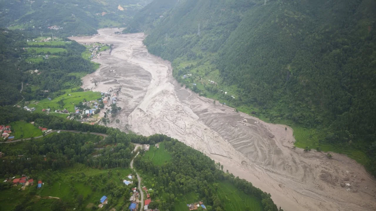
Once it started, the water took a fixed route from the mountain down to the plains. It went from the Langtang Lirung slope to the Lhende Khola. From there it flowed to the Bhote Koshi, then the Trishuli. It finally reached the Narayani and Gandak system.
Experts call this a cascading disaster. That means no single event explains the damage. Each stage created the next one. The destruction grew as the water moved south.
Stage one, the collapse: A north-facing slope broke away at about 8:37 a.m. NDRRMA estimates the area at about one square kilometre.
Stage two, the fall: The mass picked up more mud and water as it fell. It left the mountain as a fairly dry avalanche. By the time it reached the valley floor, it had become thick, moving sludge.
Stage three, the blockage: The debris blocked the Lhende river, and water built up behind it has more kept arriving from upstream. Two lakes were formed. Chinese experts named the long one beside the Lhende Khola “Barrier Lake-1.” They named the pool in the impact crater “Barrier Lake-2.”
Stage four, the break: The blockage gave way. All the stored water and debris went downstream at once. Rasuwagadhi, Timure and Syabrubesi were hit first.
Stage five, the spread: The wave moved south along the Trishuli. It reached each district in turn over the next seven hours.
Barrier Lake-1 later filled again and sent a second flood down the Bhote Koshi. This forced rescue work on the Chinese side to stop for a time. China has since confirmed that the lake has now drained away.
Timeline of the First Day
The scale of the disaster becomes clear when you look at the first hours minute by minute.
| Time (NPT) | Event |
| 8:37 a.m. | Seismic stations record the collapse |
| 8:45 a.m. | Government receives the first report |
| 8:50 a.m. | Syabrubesi river gauge stops sending data |
| 9:00 a.m. | District offices start warning riverside villages |
| 9:15 a.m. | The hydrology department confirms a major flood wave. |
| 10:28 a.m. | Flood reaches Galchhi |
| 10:30 a.m. | Rescue team gathers at Tribhuvan International Airport |
| 11:50 a.m. | Flood reaches Malekhu |
| 1:00 p.m. | Flood reaches Mugling |
| 3:20 p.m. | Flood reaches Devghat |
| 4:00 p.m. | Peak flow recorded at Devghat |
The Syabrubesi gauge sent a final reading of 1.62 metres before it went silent. That is not the height the water actually reached. The station was destroyed before the worst of the flood passed it. That is one reason so little was recorded in the upper valley.
Gauges further downstream caught the full scale of the surge. ICIMOD recorded a rise of about nine metres at Galchhi in just half an hour. Malekhu rose about seven metres in a similar time. NDRRMA put peak flow at Devghat at around 5,850 cubic metres per second. The total volume was about 57.40 million cubic metres. Nearly 19.96 million of that was extra water above the normal level.
Nepal Telecom and Ncell sent 679,295 warning messages that day. In the lower Trishuli valley, those texts made a real difference. One alert reached a school in Bidur about fourteen minutes before the water. Around 900 students were moved to higher ground in time. In Rasuwa itself, no warning could possibly have arrived fast enough.
The Death Toll and the Missing
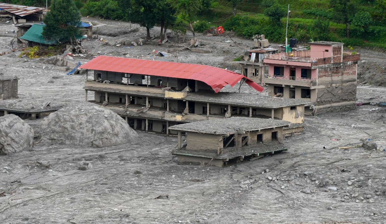
The figure of 1,355 bodies recovered needs to be read with care. Most reports have not done that. These are bodies recovered, not deaths in the district where the body was found. The Trishuli and the Narayani carried people more than a hundred kilometers, so districts far downstream have found large numbers of victims who died much higher up.
Bodies Recovered by District in Nepal
| District | Bodies recovered |
| Chitwan | 363 |
| Nawalparasi West | 221 |
| Nawalparasi East | 222 |
| Nuwakot | 197 |
| Rasuwa | 169 |
| Dhading | 70 |
| Tanahun | 38 |
| Total | 1,355 |
The distribution continues to show why downstream districts have recorded large numbers of recovered bodies. The flood and river system carried victims and remains far from the initial impact zone, so a high recovery total in Chitwan or Nawalparasi does not mean those districts suffered the same direct physical destruction as Rasuwa or Nuwakot.
Chitwan sits at the top of the table, but the flood was not worst there. The district has a long, open stretch of the Narayani where bodies came to rest. Search teams could work easily there. The same is true of both Nawalparasi districts and of Tanahun.
Bodies are counted where they are finally received and identified, not where they were initially swept away. Some partial remains may also have been merged into single records as forensic analysis progresses. NDRRMA continues to verify and reconcile district records with national figures.
Nepal has named eight primary districts as significantly affected by the disaster: Rasuwa, Nuwakot, Dhading, Gorkha, Chitwan, Nawalparasi East, Nawalparasi West, and Tanahun. About 1.6 million people live across this broader affected area. That figure shows the total population exposed to the disaster, not the number of displaced individuals.
Body Identification Progress and Delays
Finding the dead is no longer the hardest part. Naming them is.
The Ministry of Health says only about 4 per cent of the roughly 900 bodies found by early this week had been identified. Mortuaries in the affected districts filled up within days. So did mortuaries in Kathmandu. Officials have started burying unidentified victims in wooded areas outside the capital.
Forensic teams from India, China, Japan, Singapore and South Korea were assisting Nepal with DNA collection, analysis and disaster-victim identification.
As the number of recovered bodies increased, authorities began temporarily burying unidentified remains after collecting forensic evidence and DNA samples. Nepal Police asked immediate relatives of missing people to contact Nepal Police Hospital in Kathmandu or the nearest district police office. Relatives living abroad were asked to prepare DNA profiles through the relevant authorities in their countries and send them to Nepal Police at [email protected]. Forensic and disaster-victim-identification teams from India, China, Japan, Singapore and South Korea joined Nepali authorities to accelerate identification.
Foreign Nationals Missing in the Bhotekoshi Flood
As of 7 September, approximately 589 foreign nationals from 35 countries remained missing in Nepal, according to the Ministry of Foreign Affairs. More than 300 foreign nationals had been rescued. The government warned that foreign-national figures were still being verified as diplomatic missions and families compared records with Nepali authorities.
The Hydropower Tunnel Rescue in Rasuwa and Nuwakot
The hardest part of the whole operation has been underground, and it is still going on.
Nepal has built many hydropower projects over the past twenty years. Most of them use long tunnels cut through the hills. The tunnels let developers use the steep drop between a Himalayan river and a powerhouse lower down. Some run for several kilometers, and workers were inside them when the flood came.
Hydropower Workers Still Unaccounted For
Officials and project operators report roughly 900 workers missing or unaccounted for across the affected hydropower projects. These approximately 900 missing workers are included in the overall national missing count of 4,996. The exact count remains subject to verification because worker registers were incomplete and some individuals may have escaped without immediately contacting authorities.
Tunnel Rescue Progress by Project
Army Headquarters gave this update on the morning of 2 September:
- Rasuwagadhi Hydropower: Teams got about 150 metres in before large rocks stopped them.
- Langtang Hydropower: A team of 25, including foreign rescuers, has reached about 150 metres and is still working.
- Upper Trishuli-3B: 61 soldiers, three civilians and the project manager found the office and staff quarters. They used an excavator to open a route.
- Upper Trishuli-3A: Crews drilled in from above, pumped in air, lowered a camera and dropped food. They are now cutting a second route with a Bobcat.
- Chilime: Nepali and Indian Army teams went in but were stopped by mud.
- Upper Trishuli-1: Army teams are searching at Haku.
Bhairaja Maharjan runs the Chilime project. He described the blockage plainly. He said “there is an ocean of it there.” He compared the work done so far to taking out a single litre of water. A mountain guide at another site told Reuters that walking in was impossible. He said one of the two excavators at his site was broken. The other was being repaired.
Obstacles Slowing the Tunnel Rescue
The problems have piled up on each other:
- Three to four metres of packed mud inside some tunnels
- Blocked or collapsed entrances
- Broken access roads, so excavators could not reach the sites at all
- Rocks and abandoned machines blocking the passages
- No contact of any kind with the people inside
- Incomplete worker lists at construction sites
- Standing water that has to be pumped out first
- Poor air inside, and the risk of low oxygen
- Weak sections that could still collapse
- Rain and rising rivers that forced teams to pull back more than once
Helicopters have carried excavators, generators and bridge parts to sites that trucks can no longer reach. Finding safe landing spots took days. Building a track from each landing spot to the tunnel mouth took even longer.
The tunnel operation later produced several major breakthroughs. On 4 September, nine days after the flood, rescuers pulled two Nepali workers alive from the Upper Trishuli 3A hydropower tunnel. On 5 September, a Chinese national was rescued from the Upper Trishuli 1 tunnel, while a Nepali woman was found alive inside a mud-filled house in Betrawati. The government’s 7 September update recorded four people rescued alive during the four days from 4 to 5 September, including two Nepali nationals from Upper Trishuli 3A, one Chinese national from Upper Trishuli 1 and one Nepali national from Betrawati.
The rescue of people after nine and ten days underground changed the operation’s tone, even though the chances of finding further survivors were becoming more uncertain. Officials continued to search Upper Trishuli 1, Upper Trishuli 3A, Upper Trishuli 3B, Chilime, Rasuwagadhi and Langtang. Rescue teams from India, China and South Korea were working with the Nepali Army, while teams from the UAE and Malaysia also joined the operation.
Late survivor rescues: On 4 September, Sanjay Sah and Kabir Maharjan were brought out alive from the Upper Trishuli 3A tunnel after being trapped for nine days. Sah later said he had remained in the tunnel while trying to help others escape. On 5 September, rescuers recovered a Chinese worker alive from the Upper Trishuli 1 project and rescued a Nepali woman from a house buried in mud in Betrawati.
District by District Damage
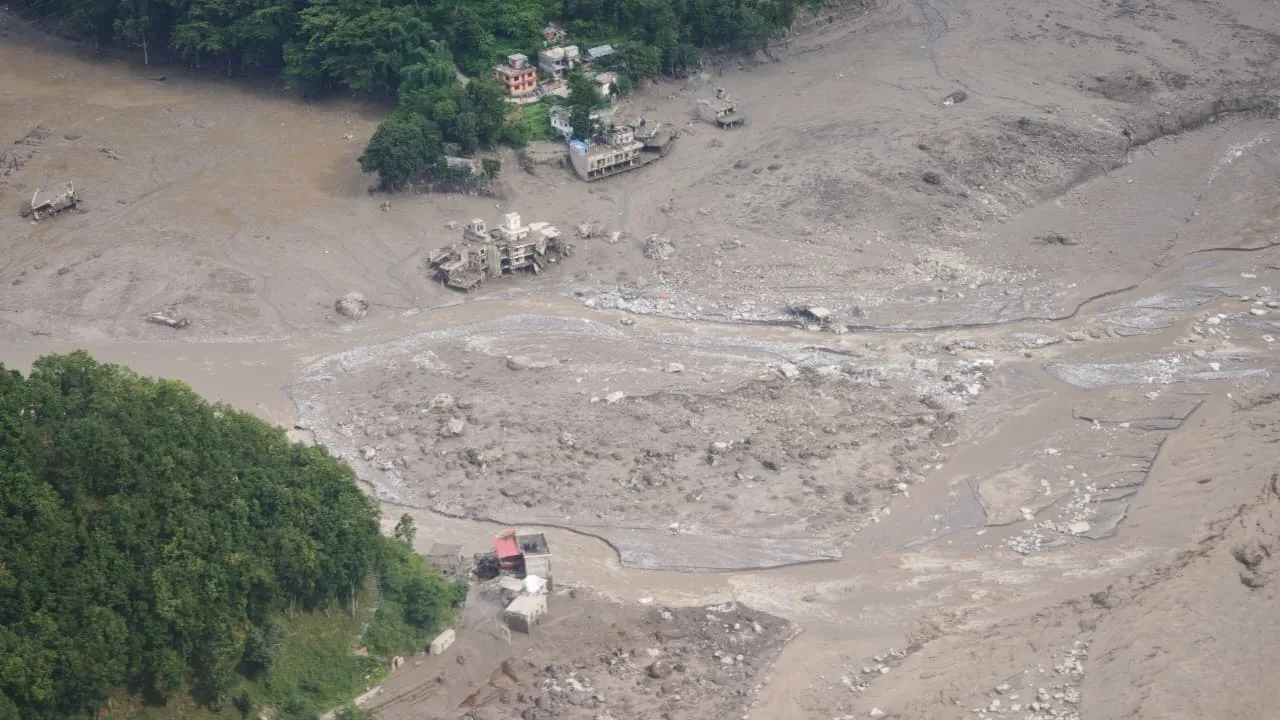
The flood did not have the same effect on all the districts, and the figures don’t make much sense without taking that into account. The upper districts suffered the full force of the water and, within the first hour, lost bridges, roads, power lines and entire settlements. The lower districts escaped most of that damage, but they did end up receiving the bodies since the Trishuli and the Narayani carried the victims for more than one hundred kilometers.
Taking the district numbers together as a single ranking leads to a misleading impression. The following section shows the damage done in each district alongside the recovery work it has had to carry out.
Rasuwa District Damage
Rasuwa was hit first and hit hardest of all the districts. The flood reached Rasuwagadhi, Timure and Syabrubesi within minutes, and destroyed almost everything the district needed in order to respond.
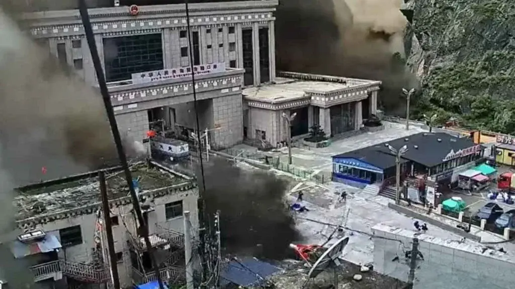
The customs and immigration complex at Rasuwagadhi is gone. So are the border trade and dry port buildings and the Nepal-China Friendship Bridge. The bridges at Timure and the Syabrubesi crossing went too, as did the roads to the border. Police posts, quarantine buildings, national park offices, health posts, phone towers and village water systems were also destroyed.
NDRRMA reported 3,702 households cut off in Gosaikunda and Aamachhodingmo. That covers 14,461 people, including 3,650 children and 1,204 elderly residents. They lost road access, power, phone service, food supplies, medical care, schools and markets. These households are cut off, not destroyed. The two things should not be confused when the figures are quoted.
Health posts at Syafrubesi, Timure and Mailung were damaged or destroyed. With the roads gone, repair crews still cannot bring materials up the valley. That is why Rasuwa is the slowest district to get its basic services back.
Nuwakot District Damage
Nuwakot has the clearest housing record of any district. It lost 1,267 houses completely and another 1,253 in part. It has recovered 155 bodies.
The flood hit Trishuli Bazaar, Betrawati, Bidur, Belkotgadhi, Kispang, Tarkeshwar, Devighat, Tupche and Simchaur. Both Betrawati bridges went, along with the Tupche bridge, the crossings at Trishuli Bazaar, the Simchaur bridge and the Devighat Mid-Hill Highway bridge.
Water systems suffered badly across the whole district. The Bidur Water Supply Project lost 4.5 kilometers of pipeline and three sump wells. That affected around 4,000 households. Damage to the Trishuli Colony, Devighat and Betrawati systems hit another 465 households. Two wastewater plants at Dhunge and Bidur were destroyed outright.
Farmers lost 4,440 ropani and bigha of crops, 2,035 animals and 16,500 birds.
Relief has not reached everyone equally, even within the same district. NDRRMA found villages in Tarkeshwar with no shelter and no supplies. Kispang had basic supplies but still faced road and power problems. Aid arriving in a district does not mean aid arriving in every ward.
Dhading District Damage
Dhading has recovered 59 bodies. Galchhi, Gajuri, Benighat Rorang, Siddhalek, Malekhu and Ghatbesi are among the affected areas.
The Syaltar road bridge, the Ghatbesi bridge, the Phurke Khola bridge and two bridges on the Kolpu Khola were damaged. Four local areas needed emergency drinking water. Galchhi asked for a 300-metre pipe to restore supply to about 100 households.
Landslides also blocked the Prithvi Highway inside the district. This has affected traffic across central Nepal.
Gorkha District Damage
Gorkha has recovered 66 bodies. It was hit directly while also receiving bodies carried down from upstream. Riverside villages were damaged, roads were cut, and search teams have spread into its stretch of the river. Families from other districts have travelled through Gorkha looking for missing relatives.
Chitwan and Downstream District Recovery
Chitwan has recovered the most bodies of any district, at 348. Nawalparasi East follows with 217. Nawalparasi West has 190. Tanahun has 38.
These districts became the centre of the search along the riverbanks. Teams there handled body recovery, identification, medical care and family tracing. The flood did not start in any of them. In most cases, the victims did not die there either.
Damage to Bridges, Roads and Power
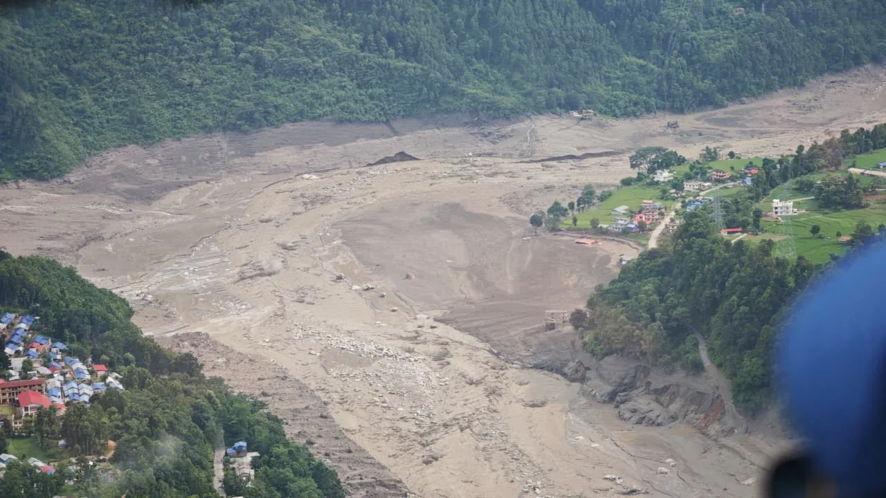
The worst losses are the Betrawati to Rasuwagadhi road, the Trishuli to Mailung and Syabrubesi road, and the Pasang Lhamu Highway. Parts of the Prithvi Highway are down too, along with the Galchhi to Devghat and Devghat to Dhunge stretches. Roads around Khalte, Simtar, Ghattekhola and Belkotgadhi were also damaged.
The main road network in Rasuwa is still entirely blocked, and in Nuwakot and Dhading some roads have partially reopened, although a number of them close at night or during bad weather.
Bridges Destroyed in the Bhotekoshi Flood
The preliminary Rapid Damage and Needs Assessment reported that 37 motorable bridges and 68 suspension bridges had been damaged. It also identified 55 kilometres of damaged roads and 48 affected government offices.
Hydropower Damage and Power Restoration
The preliminary damage assessment identified 13 affected hydropower projects, one solar power plant and two transmission lines. Approximately 783 MW of hydropower generation capacity was affected.
Telecom and Internet Restoration
Telecommunications and internet services across the affected region have seen ongoing restoration efforts. Service providers have dispatched mobile towers, satellite equipment, microwave links, generators, and battery units to re-establish connectivity in critical areas and support emergency response operations.
Homes Lost and People Displaced
The preliminary Rapid Damage and Needs Assessment (RDNA) found that approximately 7,570 houses affecting around 32,933 people had been affected. It is important to distinguish this preliminary affected figure from long-term housing needs: current estimates indicate that around 20,000 houses will ultimately need to be rebuilt or relocated due to severe structural damage or permanent land instability.
The Warning Signs That Nobody Read
Could this disaster have been seen coming? That is now the most uncomfortable question in Kathmandu, and the early answers are not reassuring. Two separate pieces of research have found that the slope was showing signs of trouble before it failed. Nobody was in a position to notice.
This does not mean the disaster was predictable to the day. It does mean the mountain was giving signals that no system in Nepal was set up to receive.
HiRISK Assessment and Pre-Event Warning Signs
An international group called HiRISK published a rapid hazard assessment on 28 August. It found that there had been “pre-event indications” in the days before the collapse.
Two of those signs were specific enough that someone could have noticed them. Meltwater coming off the glacier had turned brown, which usually means rock is being ground up somewhere above. A crack was also spreading slowly into the surrounding rock.
The report also found that no early warning system for glacier hazards had been set up in the area. Similar systems had recently been installed elsewhere in the region to watch glacial lakes on the Chinese side.
Sentinel-1 Satellite Data on Slope Movement
Manoochehr Shirzaei is a geophysicist at Virginia Tech. He studied radar images from the European Space Agency’s Sentinel-1 satellites, covering 8 January to 18 August. The last usable image was taken seven days before the collapse.
He found that the ice and rock near the failure point were creeping downhill at about 10 millimetres a month. On its own, that figure means little, since glaciers often move much faster without breaking apart.
The change in speed mattered more. The slope was moving faster in the days just before it gave way.
Shirzaei is careful about how far that finding can be pushed. The data would not have said “collapse imminent, evacuate now,” and no system could have named the hour. What it would have done, if anyone had been watching, is mark the slope as a risk worth watching closely. That gap sits at the centre of the questions now being asked.
Missing Early Warning Systems in Nepal
Most warning systems in the Himalaya are built for glacial lake floods. They watch the water level in a known lake using sensors.
Nepal runs systems like this in the Khumbu region, with sensors, weather stations and sirens. China runs a similar one at Cirenmaco lake in Tibet.
What does not exist anywhere in the region is a satellite system that watches for slopes starting to move and links that to flood models downstream. There is also no weather station near Langtang, so researchers have only satellite images to work with.
Nepali and Chinese officials met in Kathmandu in May to discuss flood risk along the border, glacier hazards, monitoring and joint response. They agreed that both sides should work together on lake monitoring and hazard mapping. The slope failed three months later.
A separate report published a year earlier had already warned Nepal about the risks in this basin.
Climate Change and Himalayan Slope Failures
Dahal’s team is looking at whether temperature swings weakened the slope. Satellite data shows the ground around Langtang heating and cooling again and again. ERA-5 records show the past two years running warmer than the 25-year average.
The swings have reached 20 degrees Celsius, from about minus 12°C to as high as 8°C. Repeated freezing and thawing is a known way of loosening frozen rock. Whether that was the deciding factor here is still being studied. The team expects to publish in two to three weeks.
Shah has said he has no doubt that climate change played a part. Rock and ice avalanches are not new in the Himalaya. Warmer conditions make them more likely, and this is by far the most destructive one on record in the range.
Inside the Rescue Operation
More than 21,000 personnel from the Nepali Army, Nepal Police and Armed Police Force have been sent to the area. Over 9,200 soldiers are working the corridor from Timure in Rasuwa down through Nuwakot, Dhading, Chitwan and Nawalparasi East.
Helicopters have done much of the work. NDRRMA logged 573 air operations by 1 September, including private flights. Aircraft carried people out and brought excavators, generators, tunnel gear, bridge parts and medical supplies in.
Relief flown from Tribhuvan International Airport has included thousands of blankets, tents, sleeping bags and hygiene kits, along with rice, lentils, fuel and medicine. More than a thousand body bags went in the same loads, which says something about what the government expected to find. Medical teams have treated at least 4,070 people across the affected districts.
Factors That Slowed the Rescue Effort
The speed of the operation is not explained by one problem, several appeared in the first hour:
- The collapse occurred just minutes before the flood, giving almost no warning time upstream
- Roads and bridges were destroyed before any convoy could move.
- River gauges were lost before they could record the crest
- Phone networks in the worst-hit areas went down
- Bad weather grounded the helicopters and there were few landing areas on the terrain
- Construction site worker lists were incomplete
- Unstable barrier lakes forced teams to turn back more than once
The collapse initially created barrier lakes and temporarily disrupted rescue work because of the risk of additional flooding. The immediate threat from these barrier lakes has since eased as they have drained or stabilized. However, significant hazards remain due to debris-blocked channels, landslides, unstable slopes, and damaged river infrastructure.
International and Domestic Help
International assistance expanded as the rescue operation became more technically difficult. India, China and South Korea provided tunnel-rescue teams working with the Nepali Army. Teams and equipment from Malaysia and the United Arab Emirates also joined the operation, while Australia and other partners contributed rescue personnel, drones or relief support. Nepal requested additional high-capacity drones, LiDAR, Bailey bridges, DNA-testing equipment, ground-penetrating radar, high-capacity pumps, laboratory freezers and specialist mud- and tunnel-rescue equipment.
Total foreign assistance passed 42 million US dollars by 1 September, and Shah expects it to rise.
| Country or body | Main contribution |
| China | More than 2,100 rescue workers, about 50 tonnes of supplies and at least 220 million yuan |
| India | Around 57.5 tonnes of relief goods, tunnel specialists, a forensic DNA team and medical staff |
| South Korea | A 44-member relief team and about 1 million dollars |
| United Kingdom | Around 5 million pounds in emergency support |
| Australia | About 1 million dollars |
| United States | About 500,000 dollars and advisory support |
| UN agencies | Appeals and allocations of more than 23 million dollars |
India and China have led the response. That makes sense, given how close they are and how far the flood reached across the border. Japan, the UAE, Qatar, Singapore, Bangladesh, Pakistan, New Zealand and Canada have sent condolences, pledges or supplies, though not all of those pledges have arrived yet.
The UN Development Programme estimates the flood left about 2.2 million tonnes of debris behind, which includes approximately 556,200 tonnes of building debris.
Domestic Relief Fund and Donations
Donations moved fast in the first days after the flood. The Prime Minister’s Disaster Relief Fund took NPR 273.3 million in six hours. It passed NPR 1.9 billion within 36 hours. It crossed NPR 6.36 billion by 31 August.
Most of Nepal’s commercial banks gave. So did large manufacturers, insurers, telecom firms and Nepalis living abroad. NDRRMA has asked organisations to send donations through official channels. It has warned people against unofficial collections.
Government cash relief has been far smaller than the public donations. Rasuwa and Nuwakot received Rs 10 million each. Dhading received Rs 5 million. Another Rs 67.5 million went to 15 local governments. Shah announced a further Rs 1 billion for rebuilding on 2 September. Insurance companies have agreed to make advance payments on flood claims.
Health Risks in the Affected Areas
Of the 292 people recorded as injured, 182 have been discharged. Health posts across the upper valley were destroyed. So the hospitals still standing at Trishuli, Dhading and Baireni have taken on the extra load.
Officials are watching for outbreaks of fever and diarrhoea. The main risks now are dirty drinking water, broken sanitation, a shortage of hygiene supplies, dead animals, unidentified human remains and crowded shelters. About 65,000 people need emergency water and sanitation help. UN agencies say more than 22,000 children need protection services.
The Economic Cost Beyond the Flood Zone
The damage reaches well past the districts the water actually touched.
Rasuwagadhi was one of Nepal’s two main land trade routes to China, carrying vehicles, containers, consumer goods and industrial supplies. Its customs and dry port buildings are gone, and goods worth billions of rupees are feared lost.
Kathmandu now has an LPG shortage because the damaged roads have cut supply lines. About 200 trucks have been rerouted and new distribution rules were introduced this week. Tourist arrivals fell in August, and shops, markets, farms, daily wage work and banking along the river corridor have all been disrupted.
Nepal plans to claim on the UN loss and damage fund, which would make it one of the first countries to do so.
Government Response and Political Pressure
The Cabinet met on the day of the disaster and declared the affected local areas as disaster crisis zones for three months. The declaration falls under Section 32 of the Disaster Risk Reduction and Management Act, 2074.
It also approved free emergency treatment at government hospitals and army facilities. Ministries were told to move stranded people and house families who lost homes. They were also told to restore roads, water, power and phone lines. Bereaved families will receive compensation under existing law.
Shah told parliament that the government had stayed in touch with provincial and local officials from the start. He also met a team led by the chief minister of Bagmati Province while visiting the area.
By 7 September, the operation had entered a combined search, recovery, relief and early-reconstruction phase rather than a simple rescue operation. Security forces and specialised international teams were still searching hydropower tunnels and isolated settlements, while authorities recovered bodies, collected DNA evidence, restored roads and telecommunications, and delivered relief to displaced communities. The government was finalising a Rapid Damage and Needs Assessment and beginning a broader Post-Disaster Needs Assessment to calculate reconstruction requirements.
Nepal observed 7 September as a national day of mourning for the victims. Government offices and Nepali diplomatic missions flew the national flag at half-mast while search and recovery operations continued.
Figures That Are Not Final Yet
- The total number of bodies recovered versus the final casualty count
- The final missing count, and how many of the 4,996 will later be confirmed dead
- The final breakdown of the ~7,570 affected houses vs. the estimated ~20,000 houses requiring full rebuilding or relocation
- The total number of families displaced
- Total bridge losses across all districts
- How much hydropower capacity is lost for good rather than just offline
- The total economic cost
- How many tunnel workers were killed, rescued or are still missing
- The full list of foreign casualties
- The final scientific classification of the event
- The exact size of the block that fell
Even the height of the fall is still disputed. NDRRMA first said about 1,400 meters. International agencies reported roughly 1,200 meters. Dahal’s team puts it closer to 2,000 metres. Each one measures from a different starting point, so none should be treated as final.
Frequently Asked Questions
What caused the Bhotekoshi flood?
- A block of glacier ice and rock broke away from Langtang Lirung on 26 August 2026. It started falling at about 5,200 metres. The mass quickly turned into a flood. It travelled almost 100 kilometers down the Lhende Khola, Bhote Koshi and Trishuli rivers, destroying infrastructure and settlements along the way.
How many people died in the Nepal flood?
- By 7 September 2026, Nepal had recovered 1,355 bodies, 4,996 people remained missing or unaccounted for, and 13,396 people had been rescued. Chinese authorities separately reported 43 deaths and 519 missing people in Tibet as a result of the disaster.
Was the Nepal flood a glacial lake outburst flood?
- No. The evidence points to a rock and ice avalanche instead. No large glacial lake emptied to start the event. Two lakes did form afterward, behind debris that blocked the river, but these formed because of the collapse. They did not cause it.
Did the flood come from Nepal or Tibet?
- The collapse happened on the Nepali side of the border, on Langtang Lirung. The river is shared between the two countries, so the flood hit both Rasuwa district in Nepal and the Gyirong area in Tibet, within minutes of each other. Chinese authorities separately reported 43 deaths and 519 missing people in Tibet.
Which districts were worst affected?
- Rasuwa and Nuwakot are listed as severely affected. Dhading, Gorkha, Chitwan, Nawalparasi East, Nawalparasi West, and Tanahun are among the eight main districts impacted. Bodies have been recovered as far downstream as Nawalparasi and Tanahun, since the rivers carried victims well beyond the districts hit directly by the flood itself.
How many hydropower workers are missing?
- Officials and project operators report roughly 900 workers missing or unaccounted for across affected hydropower projects (which are included in the overall missing total of 4,996). Nearly 600 worked at Upper Trishuli-1. Four people were rescued alive between 4 and 5 September, including two Nepali nationals from Upper Trishuli 3A and one Chinese national from Upper Trishuli 1.
Could the disaster have been predicted?
- Scientists found warning signs, but only after the fact. These included brown meltwater, a spreading crack and satellite data showing the slope speeding up. No glacier warning system existed in this area. Researchers say the signs justified closer monitoring, but not an exact evacuation order.
Is there still a risk of more flooding?
- While the immediate threat from barrier lakes has eased after draining, Chinese state media has warned that glaciers around the impact crater could still collapse. The river channel remains unstable and heavily silted with sediment, maintaining ongoing risks of localized flooding.
How can people donate to help flood victims safely?
- NDRRMA has asked people to donate through official routes, such as the Prime Minister’s Disaster Relief Fund. It has warned against unofficial collections. The official fund had already raised more than NPR 6.36 billion by 31 August. Nepal’s commercial banks, major manufacturers, insurers, telecom companies and the Nepali diaspora all contributed.

Related Blogs